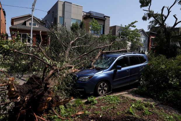
On Monday, the National Weather Service in Chicago issued 16 tornado warnings — the most they’ve sent out on a single day since 2004. The office confirmed that at least 28 tornadoes swept across northern Illinois and northwest Indiana on Sunday and Monday night as peak wind gusts reached more than 100 mph.
Illinois has already experienced over 100 tornadoes this year, though the state typically averages 50 tornadoes annually.
This is likely because the air in the Midwest is becoming more saturated with humidity, a key ingredient of strong thunderstorms that can produce tornadoes. As climate change intensifies, so do favorable conditions for this kind of severe weather that has cost billions of dollars in recent years.
Monday’s tornadoes were part of a derecho, a widespread and long-lived storm with damaging winds. It is a common Midwest phenomenon with roughly one happening every year. But the caliber of this derecho is generally only seen once every five to 10 years, said Brett Borchardt, a meteorologist with the weather service’s office in Chicago. Most recently in August 2020, a similarly “ferocious” derecho downed trees and rattled windows from Iowa to Chicago and caused $11 billion in damages.
While there are no specific temperature requirements for tornadoes to form, the air close to the ground needs to be warm and moist in relation to cooler, drier air higher up in the atmosphere. So increasingly humid summers will likely lead to intensified tornado seasons. But observations also indicate tornadoes are happening more often during nontraditional tornado months as winters become warmer and more humid.
Leading up to the heavy downpours and outbreak of tornadoes that hit Illinois earlier this week, a big dome of hot, moist air fueled storm clusters that led to four or five episodes in 48 to 60 hours.
“That’s pretty busy,” Borchardt said. “That’s a lot of storms in a short amount of time.”
Rising average temperatures globally increase humidity; for every increase of 1.8 degrees, the atmosphere can hold 7% more water.
Higher temperatures also speed up a process called evapotranspiration, by which plants such as corn absorb water through their roots and release it as water vapor.
In the Midwest, as healthy corn matures in the summertime, it acts “like a faucet” releasing moisture into the atmosphere and causing more frequent and intense rains, Borchardt said. According to the U.S. Geological Survey, 1 acre of corn can release 3,000 to 4,000 gallons of water each day as “corn sweat.” For context, the U.S. Department of Agriculture reported 11.2 million acres of corn were planted in Illinois in 2023.
Heat waves are hotter and cooling costs are rising in cities such as Chicago, studies show
By the end of the century, the warming climate will also increase the frequency of supercells — the strong, rotating thunderstorms that can produce tornadoes.
Last year, eight of nine weather events that affected Illinois and cost billions were all severe storms with what Illinois State Climatologist Trent Ford has previously called “different flavors,” including large hail, high winds and tornadoes.
So far this year, more than 1,400 tornadoes have been reported preliminarily across the United States. The average since 2010 for this time of year is 997 tornadoes, according to AccuWeather meteorologists, making 2024 the second most active year since 1950 after 2,250 were reported in 2011.
Not all tornadoes come from supercell storms. For instance, after making landfall in early July, Hurricane Beryl not only left millions of Texans without power, but according to meteorologists, also prolifically produced tornadoes all the way to upstate New York.
However, Borchardt said that the remnants of Beryl had “long passed” by the point of Sunday and Monday’s storms in Illinois.
Even if recent tornadoes were not directly related to Hurricane Beryl, the moisture that accumulated in the air and led to recent storms most likely was. And as climate change heats ocean temperatures, it adds more fuel to hurricanes, whose impacts can reverberate farther across the country.
“The warm ocean temperatures make it more likely that a hurricane will grow into a big storm, a powerful storm,” said Andrew Pershing, vice president for science at Climate Central. “And then it means that when the remnants come on land, that they’re going to be carrying more moisture, more energy, and have the potential to create more flooding, create more severe weather.”
Tornadoes spun by tropical storms form and act differently than the supercell, long-track tornadoes the Plains and Midwest often see that can travel 50 to 200 continuous miles, according to AccuWeather. When a hurricane produces tornadoes, these are fast-moving and short-lived but can still be powerfully damaging.
Yet Beryl was just the start. It was a Category 5 storm, which meteorologists say is unusually strong this early into the Atlantic hurricane season that tends to peak in mid- to late August. So tropical storms might still influence this tornado season.
Ford, the state climatologist, said the recent storms and tornadoes indicate that future severe weather will continue to affect increasingly larger swaths of the population.
“We need to be ready for severe weather and tornadoes, no matter where we live in the state,” he said.


